Okinawa6 min read
Japan's Far South: A Yaeyama & Miyako Islands Guide
A Yaeyama islands travel guide to Ishigaki, Iriomote and Taketomi, plus the Miyako group — viewpoints, mangroves, coral villages and Japan's southernmost point.
Best time: Mar–Jun & Oct–Nov (avoid Aug–Sep typhoons)
Closer to Taiwan than to Tokyo, the Yaeyama and Miyako islands are Japan's true far south — a scatter of coral outcrops where subtropical jungle meets some of the clearest water in the country. This Yaeyama islands travel guide leads with the trio most first-timers fly in for — Ishigaki as the gateway, Iriomote for its wildcat-haunted mangroves, and Taketomi for its lanes of white coral sand — then keeps going, out to Yonaguni's underwater monument, Kohama's six-island panorama, and Hateruma at the literal southern edge of inhabited Japan. Across the channel, the Miyako group adds bridge-linked islets, karst sinkholes and sunset beaches. Most of these places sit an easy ferry or bridge hop from a single airport, yet see a fraction of the crowds that pile onto the main Okinawa resorts. Come between March and June or in October and November, when the sea is calm and typhoon season has passed.
01Okinawa
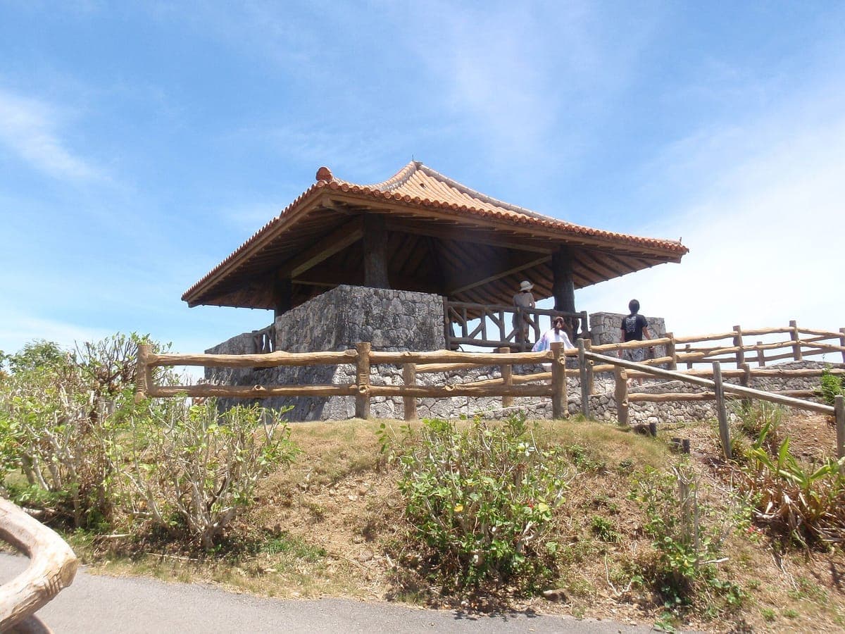
Tamatorizaki Observation Point
玉取崎展望台
Perched on the narrow isthmus of northeastern Ishigaki, this hilltop deck looks out over the Pacific and the East China Sea at once, with a short hibiscus-lined path leading up to the view. It is one of Ishigaki's most photographed spots, especially at sunrise, yet plenty of travelers skip it in favor of the popular beaches and resorts. A quick, free stop that frames the island's wild coastline better than almost anywhere else. Getting there: On the east coast of Ishigaki Island, about 30 minutes by car north of central Ishigaki City via Route 390; free parking on site. Open 24 hours. Free. Best year-round.
02Okinawahidden gem
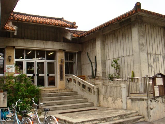
Yaeyama Museum
八重山博物館
A small but rewarding history museum in Ishigaki City, showcasing the archaeological finds, traditional crafts, artwork and folk traditions of the Yaeyama Islands. It is the easiest way to understand the culture behind the beaches you will spend the rest of your trip on — and precisely because most visitors head straight for the islands and reefs, it stays quiet. Getting there: Located in Ishigaki City, easily accessible by bus or taxi from Ishigaki Airport; a 5-minute walk from the Ishigaki Port (Rito) ferry terminal. Open Tuesday–Sunday, 9:00 AM – 5:00 PM (closed Monday). Admission ¥200. Best year-round.
03Okinawa
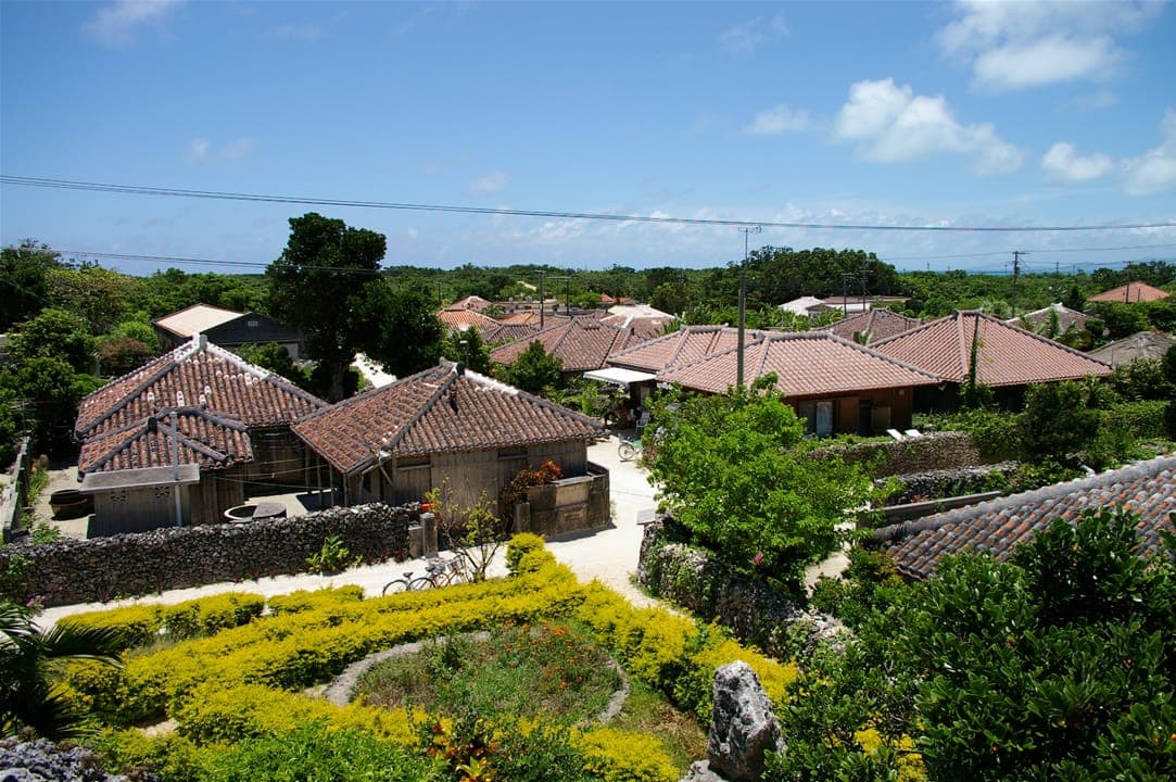
Taketomi Village
竹富島 集落
The heart of tiny Taketomi is a preserved glimpse of old Okinawa: lanes of white coral sand between red-tiled bungalows and coral-stone walls, shaded by hibiscus and bougainvillea. Explore on foot, by rented bicycle, or aboard a slow water-buffalo cart while the driver plays sanshin. Day-trippers see the village by 11am and leave by 4pm — stay the night and the real Taketomi, quiet and unhurried, reveals itself. Getting there: Ferry from Ishigaki (~10–15 min) to Taketomi Port, then bike or bus. Open 24 hours (village). A ¥300 island-wide conservation cooperation fee (not a gate fee) is paid via ticket machines at the Ishigaki or Taketomi port terminals. Best October–May (avoid typhoon season).
04Okinawa
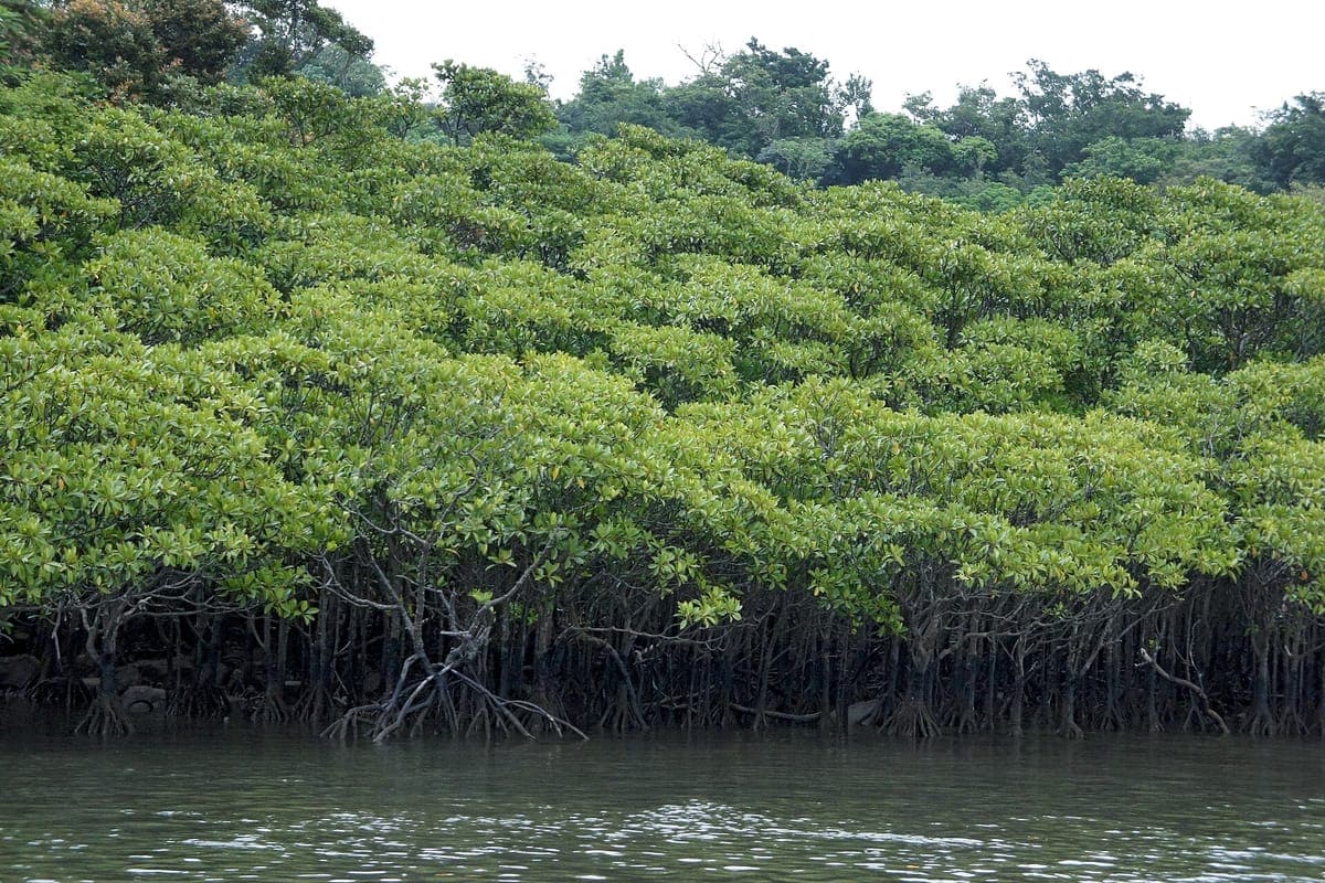
Iriomote Mangrove Kayak
西表島マングローブカヤック
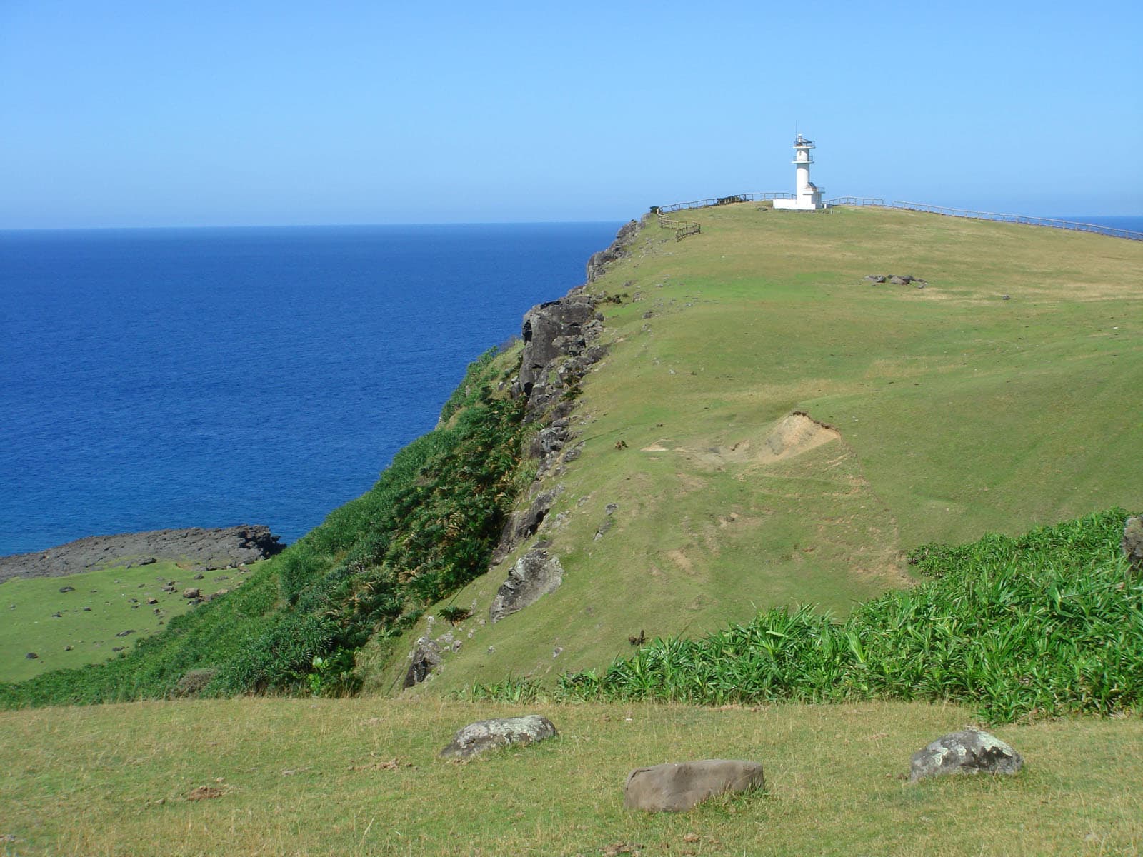
Iriomote is Japan's jungle island, and paddling its serene mangrove rivers is the classic way to experience it — gliding beneath dense canopy through an ecosystem that is home to the endangered Iriomote wild cat. Spring and autumn bring the calmest conditions. Because most travelers fixate on the main Okinawa islands, this pristine corner stays genuinely wild. Getting there: Take a ferry from Ishigaki Island to Iriomote Island, then use local transport to reach the kayaking launch points. Tour operators run roughly 8:00 AM – 9:00 PM. Best spring and autumn.
05Okinawahidden gem
Yonaguni Monument
与那国海底地形
Off Arakawabana Cape on Yonaguni's south coast lies a mysterious underwater rock formation — sharp geometric terraces and stair-like edges, discovered by divers in 1986, that have fueled decades of debate over whether it is natural or man-made. It sits 5–25m down and is reachable only by guided dive. Yonaguni is Japan's westernmost inhabited island, remote enough that mainstream travelers routinely overlook it. Getting there: Accessible by ferry or small aircraft from Ishigaki Island; the monument itself is reached only via a guided dive. Best in spring.
06Okinawa
Ufudaki Observatory
大岳展望台
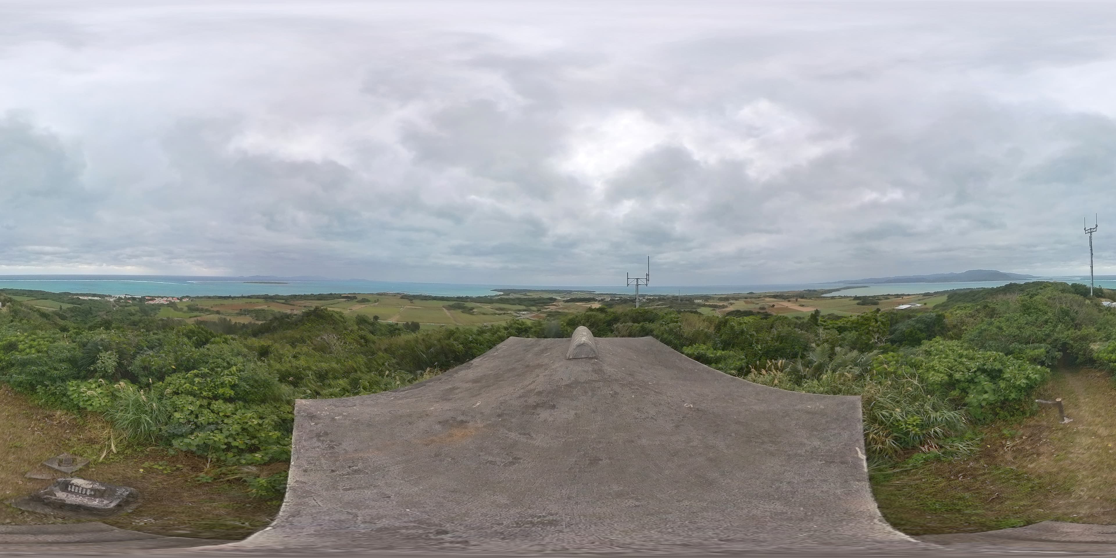
The highest point on little Kohama Island, at 99m, reached by a well-maintained staircase of roughly 300 steps. On a clear day the deck delivers a 360-degree panorama taking in Ishigaki, Taketomi, Kuroshima, Aragusuku, Iriomote, Hatoma and Kayama — and occasionally Hateruma. Kohama is usually a day-trip afterthought to Ishigaki, so this six-plus-island sweep draws a fraction of the visitors that comparable lookouts do. Getting there: From Kohama Port, ~2 min by car or ~7 min by bicycle to the trailhead parking, then the ~300-step climb (5–10 min). Rent a bicycle (electric is ideal) or car at the port. Open daily 9:00 AM – 5:00 PM.
07Okinawa
Japan's Southernmost Point Monument
日本最南端の碑
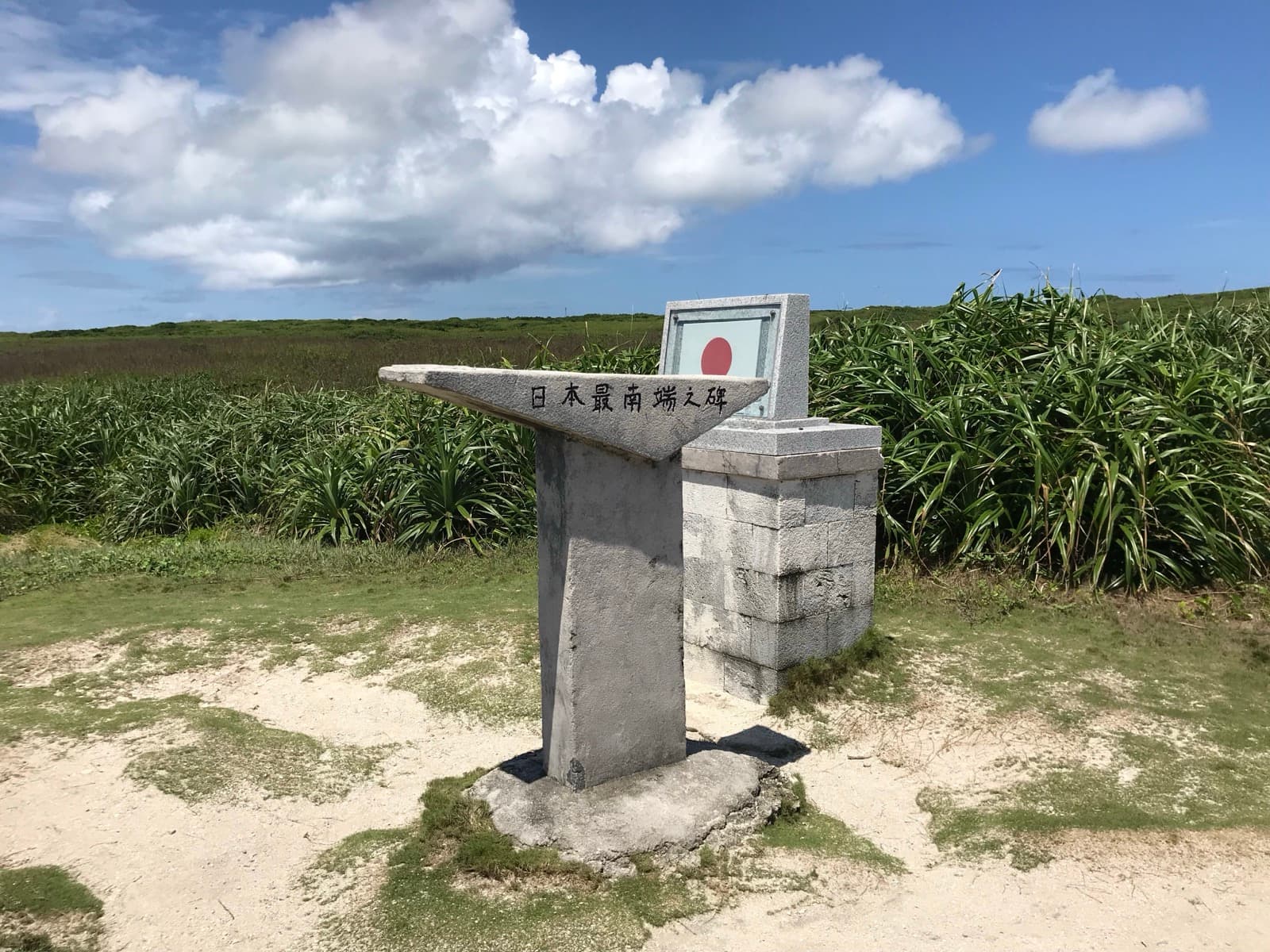
On Hateruma Island stands a self-funded concrete memorial, erected in 1970 by a traveling student, marking the southernmost point of Japan reachable on an inhabited island. Two companions flank it: a 1995 Peace Monument and a 1972 reversion memorial. It is often confused in planning with the nearby Hateruma Star-Watching Tower less than a kilometer away — but they are separate stops, and this one is a genuine must-see photo point at the edge of the country. Getting there: From Hateruma Port, ~30 min by car or bike, adjacent to Cape Takana; also ~20 min walk from Hateruma Airport, reachable by rental bicycle or car. Open 24 hours. Free (free parking for 10 cars on site).
08Okinawa
Toori-ike (Twin Ponds)
通り池
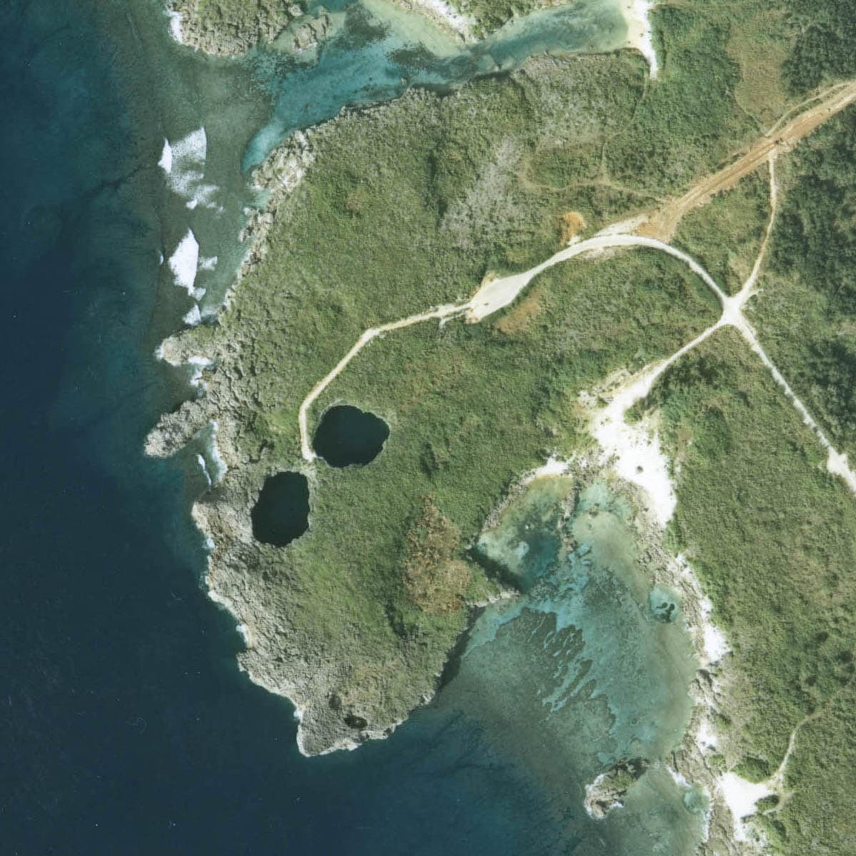
Two sinkhole ponds on Shimoji Island's west coast, 75m and 55m across, formed when a limestone karst cave system collapsed — connected to each other underground and to the open ocean through a submerged cavern. A National Place of Scenic Beauty and Natural Monument since 1979. Full appreciation belongs to advanced cave divers, so most visitors only glance from the rim, underrating just how significant this geological site is. Getting there: ~30 min by car from Miyako Airport via the Irabu Ohashi Bridge; large paved, bus-accessible lot with accessible restrooms, then a ~5 min walk on a maintained boardwalk. Open 24 hours.
09Okinawa
Makiyama Observation Deck
牧山展望台
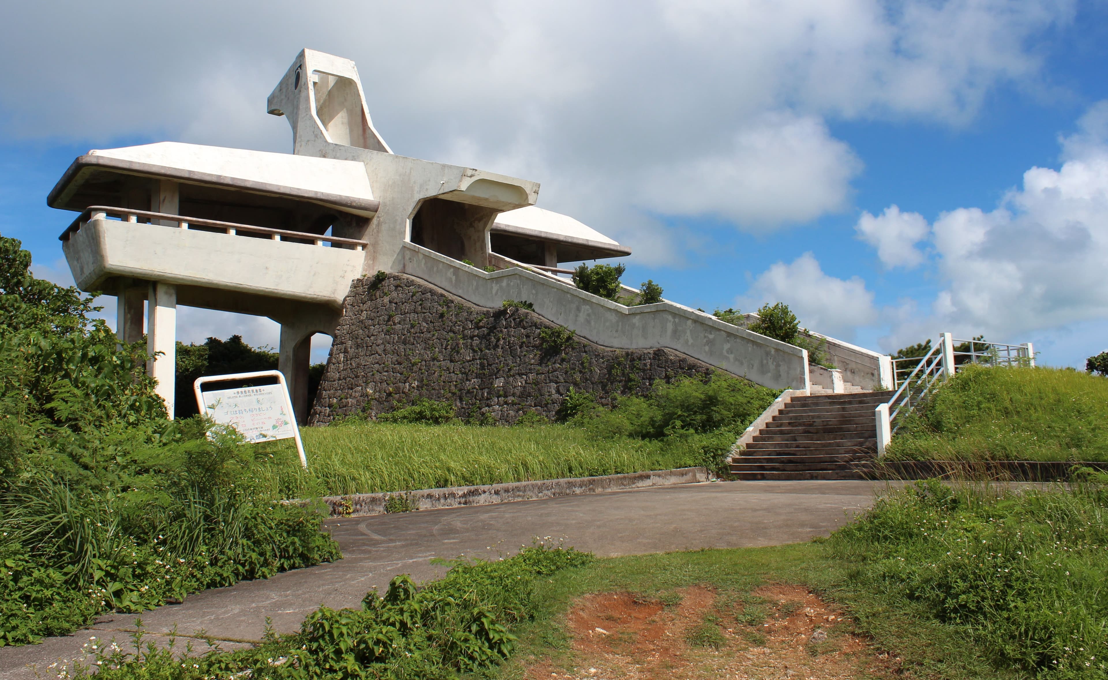
A free white tower shaped like a grey-faced buzzard (sashiba, a migratory bird) crowns Irabu Island's highest point, about 90m up, just after the Irabu Ohashi Bridge landing. On clear days it frames the great bridge, Miyako-jima, and the Ikema and Kurima bridges. Unstaffed, ticket-free and with no tour-bus stop, it is skipped by travelers who only pull over at the roadside bridge photo spots without detouring up the hill. Getting there: ~24 min by car from Miyako Airport via the Irabu Ohashi Bridge; free parking, then a few minutes' walk to the tower. Open 24 hours. Free.
Yonaha Maehama Sunset Park
Fronting one of Miyako's most celebrated white-sand beaches, this park offers stunning sunset views over the water, with well-maintained walking paths and picnic areas that make it ideal for slowing down and taking photos. A café and a water-sports rental outpost sit nearby. While crowds pile onto more famous beaches, this stretch keeps a peaceful, unhurried atmosphere. Getting there: Accessible by car or local bus from Miyako Island's main areas. Open 24 hours. Free public beach (paid parking and shower add-ons only). Best year-round.
When to go
The far south is at its best from March to June and again from October to November — calm seas, warm-but-workable temperatures, and clear water for snorkeling, kayaking and diving. Deliberately avoid August and September, the peak of typhoon season, when ferries to Hateruma, Yonaguni and the smaller islands are the first things to be cancelled. Taketomi's own guidance echoes this, favoring October through May. If your trip hinges on reaching an outer island, build in buffer days: the crossings that make these islands so quiet are also the ones weather closes first. Note too that Hateruma Sugar Factory, Japan's southernmost sugar mill, only runs its tourable harvest season roughly December through April — a rare winter-only draw in a region otherwise built around calm-sea months.
Keep exploring
- Okinawa Beyond the Aquarium — the main-island hidden spots most tours miss.
- Japan's Secret Islands — remote isles beyond the far south.
- First-Timer's 7-Day Hidden Japan — how to fit an island run into one trip.
Ready to plan? Build your own hidden-Japan itinerary → — our trip generator turns any of these spots into a day-by-day route.