Back to explore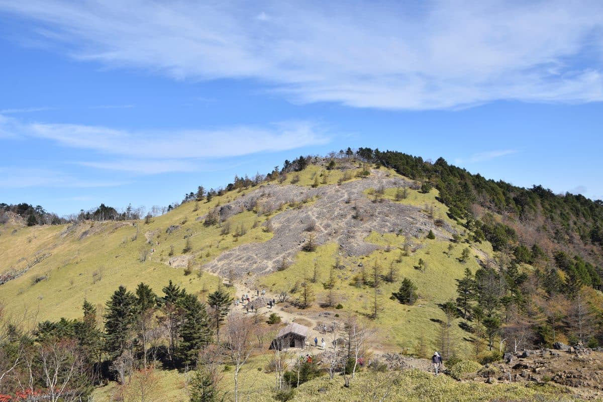
Raita Futo, CC BY 2.0, via Wikimedia Commons
Mount Daibosatsu
大菩薩嶺Yamanashi · Chubu
大菩薩嶺 is a 2,057 m summit on the eastern rim of the Kofu Basin, and the walk that reaches it spends most of its length on an open grass ridge rather than in forest. The wooded top itself has no view: the reward is the traverse between 雷岩 and 大菩薩峠, which looks south to Mount Fuji and west across the basin to the Southern Alps. Because a mountain road climbs to the 上日川峠 trailhead at 1,584 m, the standard loop gains only about 550 m over 7.2 km — which is why a 2,000 m peak here is an ordinary day on foot rather than an expedition.
- Best season
- Spring · Summer · Autumn
- Crowd level
- Popular
- Nearest station
- Kai-Yamato Station (JR Chuo Line)
How to get there
From Kai-Yamato Station on the JR Chuo Line, take the Eiwa Kotsu bus on the Daibosatsu / Kamihikawa-toge line to the Kamihikawa-toge trailhead at 1,584 m, where the loop begins and ends. Confirm current bus operation with the operator before travelling: when the mountain road is not open as far as the trailhead, the walk starts lower down and adds substantially to the day.
Tags
hikingmountain
Location
More in Chubu
Continue exploring

Your turn
Plan a trip like this — free
Built from 2,650+ verified hidden places — real routes, ferries, and events matched to your dates. Yours takes about a minute.
No credit card, plan your first trip now!