Kanto6 min read
Hidden Tokyo Day Hikes: Mountains Within Reach
The best day hikes near Tokyo off the beaten path — Tanzawa valleys, Boso gorges and Kamakura ridge trails, all reachable and back in a single day.
Best time: Spring & autumn
Everyone knows Mount Takao. Fewer travelers realize that the ring of mountains, gorges and coastal cliffs around the capital hides dozens of quieter trails you can walk before dinner back in the city. This guide collects the best day hikes near Tokyo off the beaten path — the ridge forests behind Kamakura, the clear-stream valleys of the Tanzawa range, a "Niagara of the East" gorge in Gunma, and windswept coastal paths on the Miura Peninsula. None of them require a car to be worthwhile (though a few reward one), and every trail here is a genuine walk in nature rather than a paved viewpoint. Pack water and decent shoes, check the train times home, and trade the crowds of central Tokyo for a morning of moss, sea air and mountain silence. Here are eight hikes, roughly ordered from the easiest reach to the furthest afield.
01Kanagawahidden gem
Jimmuji Forest Trail
神武寺の森
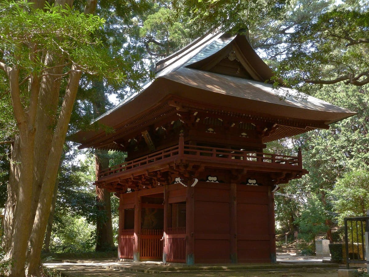
Behind the temple beaches of the Miura coast, the forest around Jimmuji hides mossy stone steps, quiet temple corners and ridge trails running toward Zushi and the Kamakura backcountry. It feels old without being crowded — most visitors pick Kamakura's famous temples and beaches instead of this inland trail network, which is exactly why it stays peaceful. It makes an ideal first hike for anyone wanting Kamakura's atmosphere without the shoulder-to-shoulder crowds. Getting there: Jimmuji Station on the Keikyu Line, about a 14-minute walk to the temple trailhead. From central Tokyo, take the Keikyu Line south (via Shinagawa) directly to Jimmuji — one of the closest true forest hikes to the city.
Miura Peninsula
The tip of the Miura Peninsula is best known for its fresh maguro tuna, but the reward for hikers is the walk out to remote Cape Misaki, where a historic lighthouse looks over the open Pacific and a sense of tranquility settles in far from the city bustle. Mainstream travelers overlook this southern cape in favor of Tokyo and Yokohama, leaving the coastal paths and the seafood markets refreshingly uncrowded. Time it for lunch and you can pair the walk with a bowl of the peninsula's famous tuna. Getting there: Misakiguchi Station is the gateway. From Tokyo, ride the Keikyu Line to Misakiguchi (or take the JR Yokosuka Line to Zushi), then a local bus toward Cape Misaki. Spring and autumn bring the mildest weather for the exposed coast.
02Kanagawahidden gem
Jogashima Island
城ヶ島
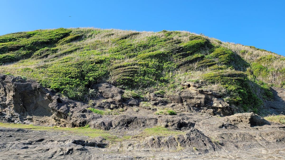
Just off the tip of Miura, Jogashima is a small island of dramatic rock formations, walking trails and a lighthouse with panoramic ocean views. It rewards a slow half-day of wandering its coastal paths and tide-carved cliffs. Many travelers skip it because it sits so close to the better-known Kamakura and Enoshima, but that neglect is your gain — this is one of the calmest coastal walks within easy reach of Tokyo. Getting there: From Tokyo, take the Keikyu Line to Misakiguchi Station, then a bus toward Jogashima; the island is linked to the mainland at Misaki Port. Spring is the classic season for clear coastal views.
03Kanagawahidden gem
Matsuda Yadoriki Valley
寄渓谷
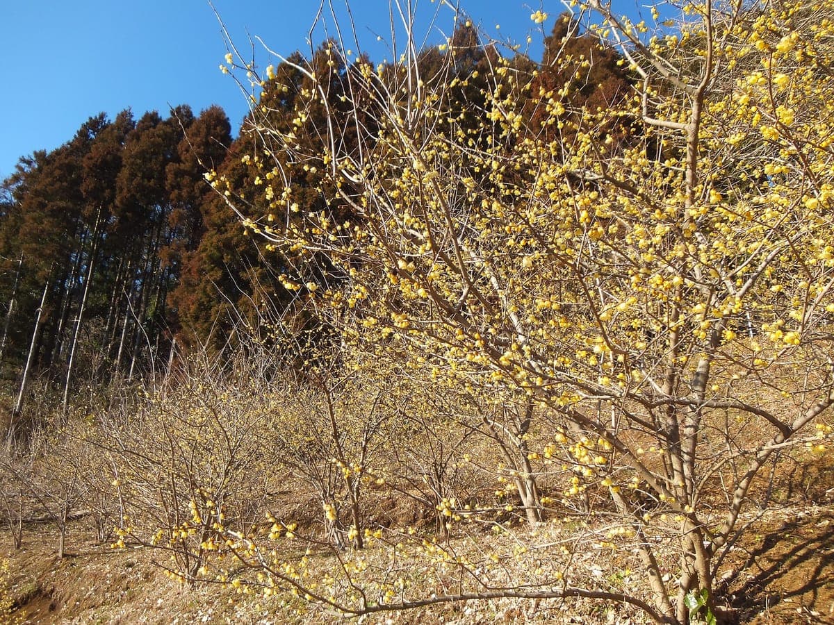
Tucked beneath the Tanzawa mountains, Yadoriki Valley is a place of clear streams, small bridges and forested picnic spots — a peaceful base for short walks or a quiet countryside escape. It stays hidden because reaching it means a local bus beyond the main Odakyu tourist corridor, so the day-trippers who fill nearby valleys rarely make it here. It is at its greenest and most inviting in summer, when the streams are cool and the canopy is full. Getting there: From Tokyo, ride the Odakyu Line to Shin-Matsuda Station, then a local bus to Yadoriki. By car it is roughly 1 hour 22 minutes from Tokyo Station.
04Kanagawahidden gem
Lake Miyagase
宮ヶ瀬湖
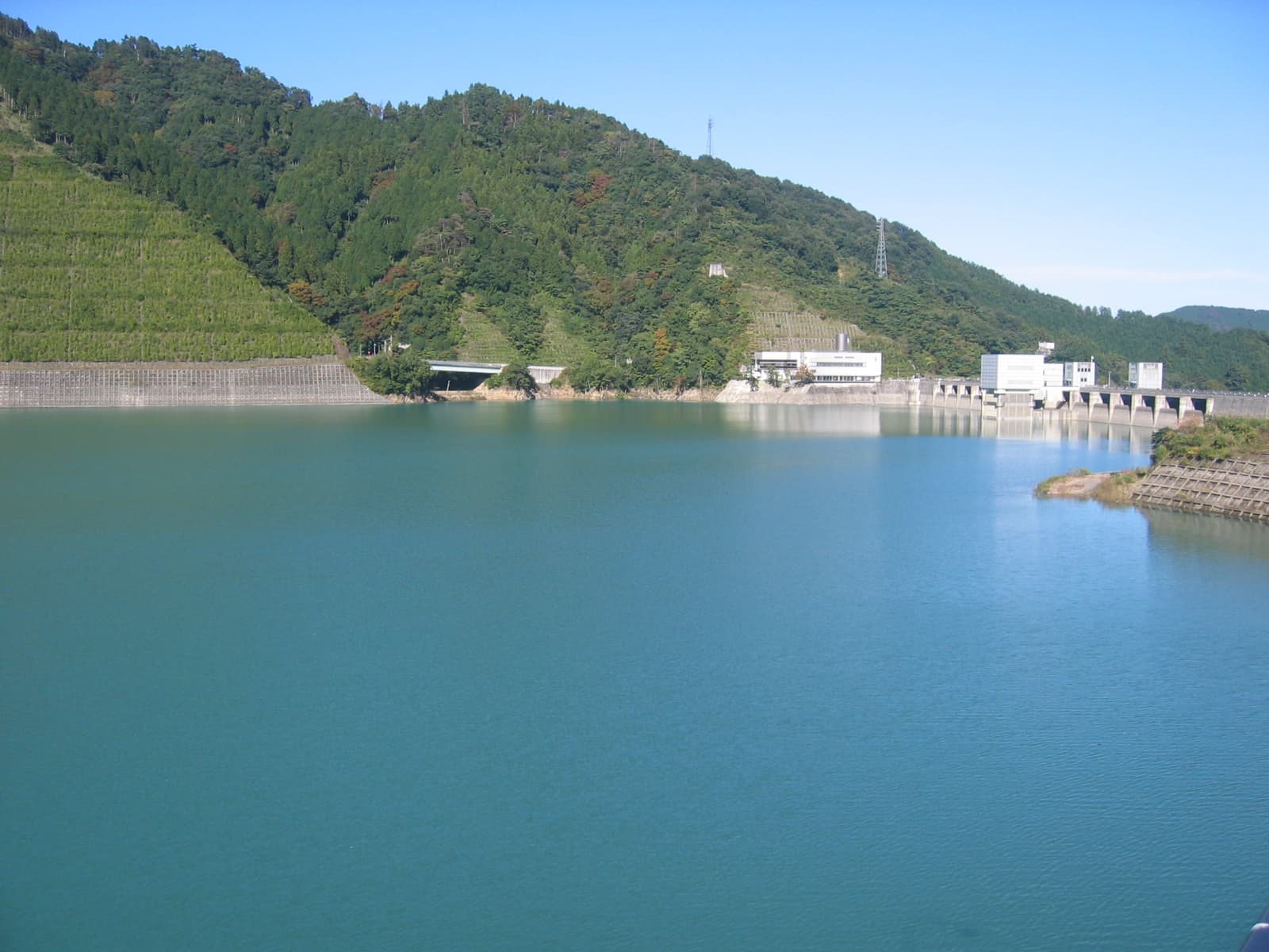
In the eastern Tanzawa mountains, Lake Miyagase is a large reservoir formed by the Miyagase Dam, ringed by walking trails and crossed by a 315-metre suspension bridge, with a visitor center and scheduled dam-discharge shows. It is counted among Japan's 100 Best Dam Lakes and draws plenty of domestic day-trippers, yet it stays almost unknown to international travelers despite genuinely easy bus access. Combine the lakeside trails with the suspension-bridge crossing for a relaxed half-day in the hills. Getting there: From Tokyo, take the Odakyu Line to Hon-Atsugi Station, then a bus bound for Miyagase, which terminates at the dam. Buses to the lake area also run from Hashimoto Station.
05Chibahidden gem
Awamata Falls (Yoro Valley)
粟又の滝
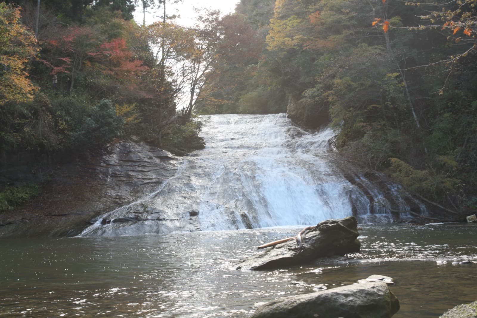
Chiba reads as coastal and flat to most travelers, which makes the interior Yoro Valley such a surprise. Awamata Falls is the largest waterfall on the Boso Peninsula — a roughly 30-metre-high, 100-metre-long nametaki, a sloped sliding-rock cascade rather than a sheer drop, with a riverside promenade running alongside it. It is one of Chiba's few true mountain-valley landscapes and is famous for autumn foliage from late November into early December, when the domestic foliage crowds finally arrive. Getting there: Ride the Isumi Railway or Kominato Railway into the Boso interior to Yoro-Keikoku Station, then a local bus (about 15 minutes) toward Awamata. Seasonal shuttle buses run from Ohara Station in autumn. The falls are free to visit; the nearby parking lot is paid (¥500 for a regular car).
06Gunmahidden gem
Fukiware Falls
吹割の滝
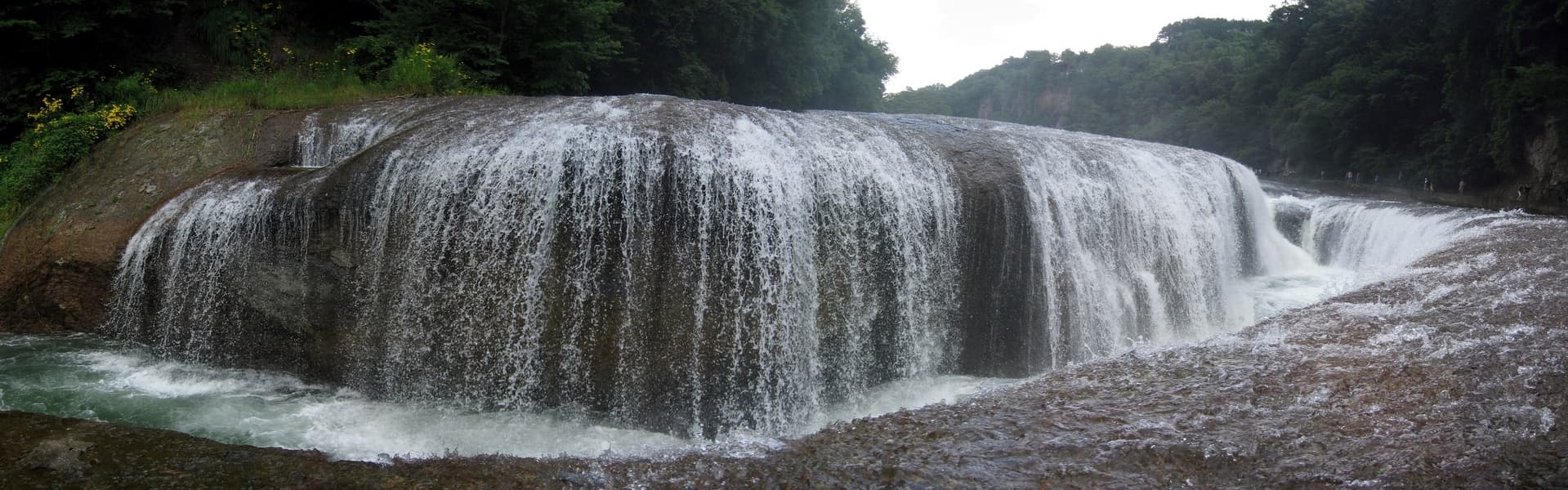
Up in Gunma near Numata, the Katashina River has split the bedrock into a dramatic gorge, earning Fukiware Falls the nickname "Niagara of the East." Only 7 metres tall but 30 metres wide, it is designated a national Place of Scenic Beauty and Natural Monument and ranks among Japan's Top 100 Waterfalls. It is well known to domestic visitors yet almost absent from foreign-language itineraries — a genuine roadside-gorge hidden gem, walked on a short riverside trail right at the water's edge. Getting there: From Tokyo, take the Joetsu Shinkansen to Jomo-Kogen Station (or the JR Joetsu Line to Numata Station), then a bus of about 40 minutes to the Fukiware-no-Taki stop. The trail is free; parking runs ¥500–1,000 depending on the lot. Note the trail closes from mid-December to the end of March.
07Tochigihidden gem
Yaita Happogahara Meadows
八方ヶ原
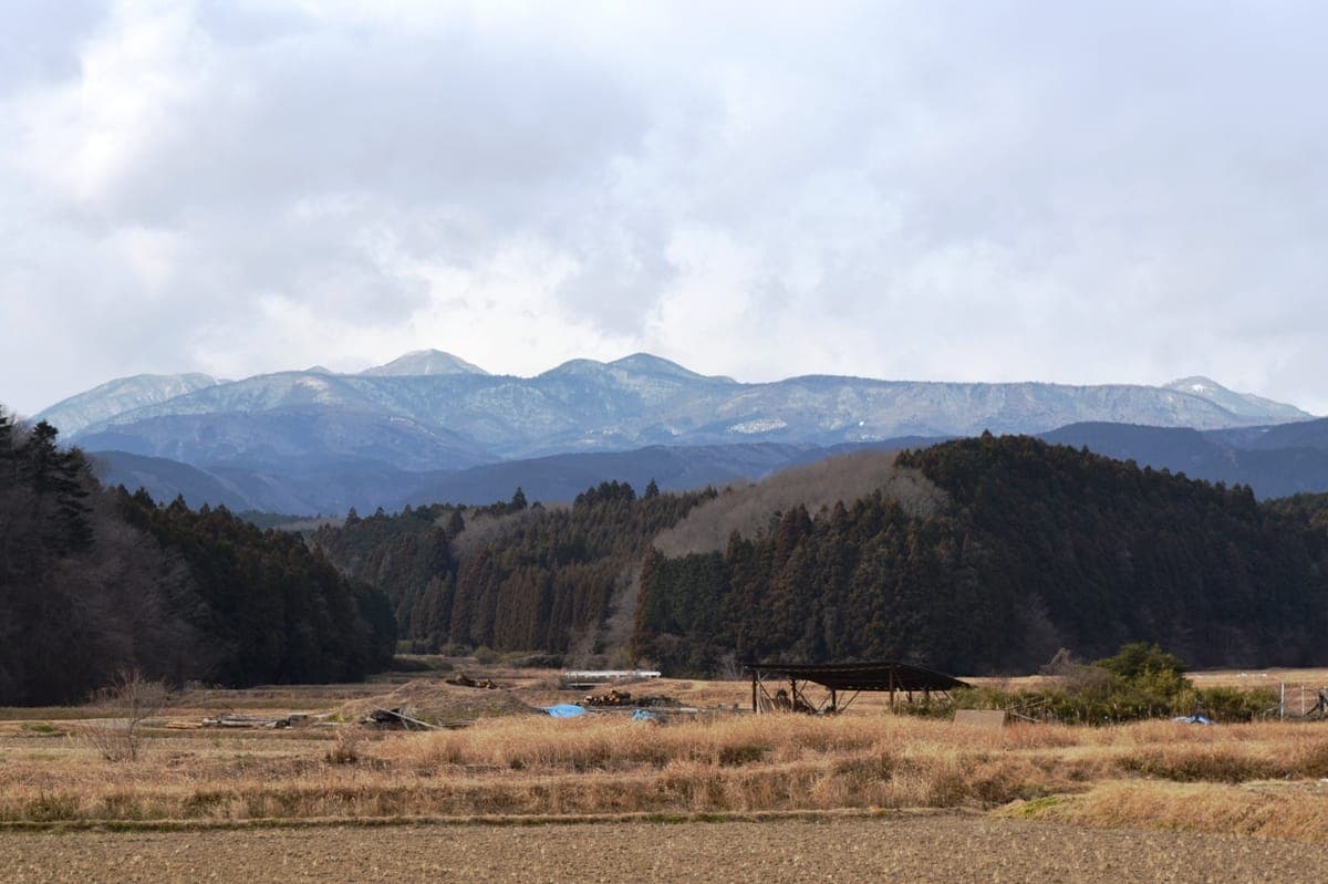
Farthest afield, Happogahara in northern Tochigi is a stretch of highland meadows, azaleas, forest trails and broad open views. It feels airy and refreshing without the resort crowds of Japan's better-known highlands, largely because it sits outside mainstream Tochigi sightseeing and is genuinely hard to reach without a car. For hikers willing to make the trip, the payoff is wide-open ridgeline walking and, in late spring, hillsides of azalea bloom. Getting there: This is the one hike here that really wants a car — roughly 2 hours 36 minutes from Tokyo Station by road, driving from the Yaita Station area up toward Happogahara, as public transport is limited. Best in spring.
When to go
Spring and autumn are the sweet spots for almost everything on this list. Spring brings mild coastal weather to Miura and Jogashima, azaleas to the Tochigi highlands, and fresh green to the Tanzawa valleys; autumn sets the Yoro Valley and Gunma's gorges ablaze with foliage, peaking from mid-November into early December at Awamata Falls. Summer suits the stream-cooled Yadoriki Valley best, while the shoulder seasons keep the exposed cape and island trails comfortable. One hard constraint: Fukiware Falls closes from mid-December to the end of March, so save Gunma for the warmer months. Whichever season you choose, start early — these are day trips, and the last bus down from a rural valley often leaves well before dark.
Keep exploring
- Kanto day trips without the crowds →
- Autumn leaves off the beaten path →
- Tokyo's hidden neighborhoods →
Ready to plan? Build your own hidden-Japan itinerary → — our trip generator turns any of these spots into a day-by-day route.